Heritage survey for restoration
We survey churches, historic buildings and monuments with laser scanning, photogrammetry and drones. From the survey we produce the drawings for the restoration project and a digital copy of the building that can be reused for years.

The façade of the church of Cascina Rubone, a two-metre detail and a 25-centimetre detail, all from the same orthophoto: one pixel is 0.92 mm.
Why a 3D survey
With a tape and a laser meter you measure the points you decided to measure. A laser scanner records millions of points from every station, and photogrammetry adds the true colour of the surfaces: the result is the complete geometry of the building, including the leaning walls, deformations and irregularities nobody planned to measure.
From this digital copy you draw what you need today, and what you will need in a few years without going back on site. For a heritage building it is also a record of its present condition, to keep in the archive and to show the building to people who cannot visit it.
How we work
The geometry comes from a Leica RTC360 laser scanner, which measures two million points per second with an accuracy of 1 mm + 10 ppm. In attics and narrow spaces we use a FARO Focus M70. Photos taken from the ground, from a pole and from a drone add colour and detail to façades, walls and vaults.
Laser and photogrammetry share the same reference system: the control points for the photos are taken from the laser point cloud (106 of them at San Babila), so orthophotos and drawings match.
A polarising filter cuts reflections on gilding and paintings, and colour is corrected so that orthophotos of different rooms sit well together.
How we check accuracy
Scans are registered in Leica Cyclone REGISTER 360, which measures the error of every link; we check them one by one before accepting the point cloud. In churches and cloisters the mean registration error has been 2 mm.
When the job requires it, a total station network, independent from the laser, is used to check the point cloud point by point. Method, instruments and errors are written in the technical report we deliver.
What we deliver
- Plans, elevations and sections in DWG and PDF at 1:50; 1:20 for monuments and details.
- Rectified orthophotos of façades, walls and vaults, including reflected ceiling views, in TIFF and JPEG.
- The point cloud, in Leica RCP or E57 format.
- Textured 3D models.
- Photos taken from the ground, from the drone and spherical photos.
- The technical report with method, instruments and checks.
For the restoration project
Restorers and architects draw the decay and crack mapping on our orthophotos. That is why we deliver them to scale, with corrected colour and enough resolution to read joints, losses and detachments.
At the Certosa monumental cemetery in Bologna we have worked for years on the restoration projects of its monuments, under the scientific direction of the Soprintendenza (the Italian heritage authority): for each project the survey, the drawings and the reports.
We also work in churches that stay open for worship, planning the days around the services.
Some projects
 Basilica of San Babila, Milan215 laser scans and 5,303 photos. Façades, interiors and vaults at 1:50.
 San Francesco di Paola, Milan349 scans, attics included, and about 5,500 photos. Mean registration error: 2 mm.
 Chiostro Annesso al Maggiore, Certosa di Bologna79 laser scans and 953 drone photos. Mean registration error: 2 mm.
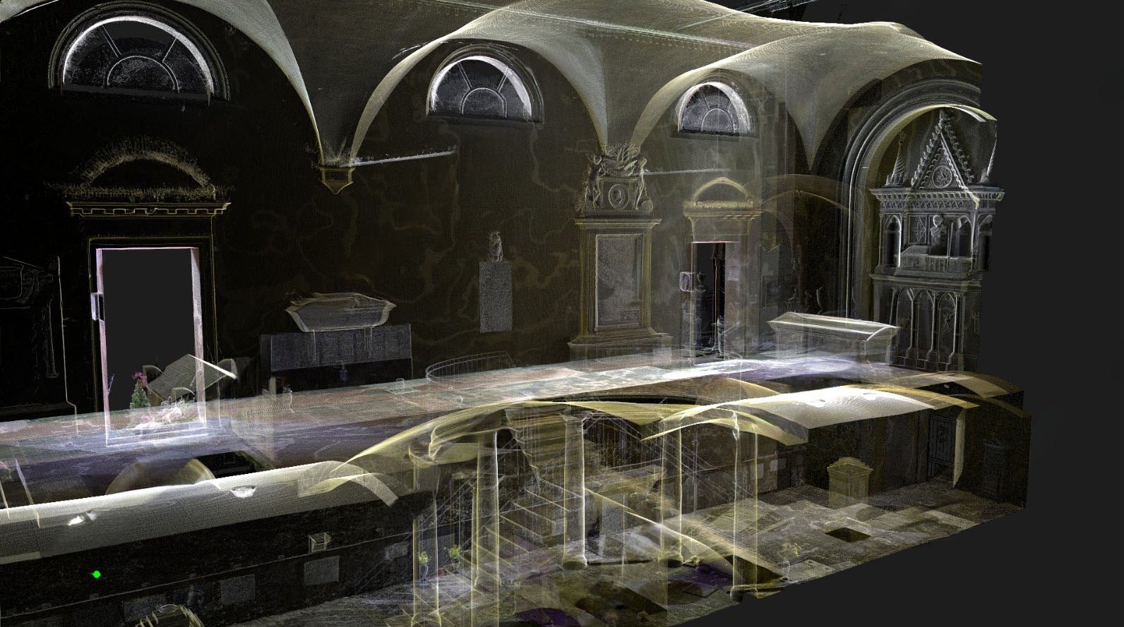 Sala della Pietà, Certosa di BolognaOrthophoto sections at 1:50 and a study of the geometry and building phases.
All examples (in Italian): churches e cemeteries.
Frequently asked questions
What is a laser scanning survey?
From every position where it is set up, a laser scanner measures the distance of millions of points around it. Joining tens or hundreds of positions gives the point cloud: a three-dimensional copy of the building, measurable everywhere, from which drawings and orthophotos are produced.
What is the difference between LiDAR and a laser scanner?
LiDAR is the name of the technique, measuring distances with a laser beam; a laser scanner is the instrument that uses it. LiDAR usually refers to sensors on drones, aircraft and phones. For architecture we use a terrestrial laser scanner on a tripod, which is far more accurate.
Does the church need to close?
Usually not. We work area by area and plan the days with the parish or whoever runs the building, so as not to get in the way of services.
Which formats do you deliver?
DWG and PDF for drawings, TIFF and JPEG for orthophotos, the point cloud in RCP or E57, textured 3D models. If the designer works with a specific software, tell us in advance.
Is the survey suitable for the Soprintendenza?
Scaled drawings and the technical report are the basis of the restoration project. What exactly is needed is agreed between the designer and the Soprintendenza: tell us at the start and we set up the survey accordingly.
What does the price depend on?
On the size of the building and how many parts must be surveyed, the scale of the drawings, access (attics, bell towers, roofs by drone) and what is delivered: only point cloud and orthophotos, or the drawings too.
What do you need for a quote?
The address, what must be surveyed (interiors, exteriors, roofs), what the survey is for and, if available, plans or earlier surveys.
Have a historic building to survey?
Tell us where it is and what the survey is for, and we will reply with a quote.